星目探宇
科普知识大合集
星目探宇
首页
奇妙科普
天文摄影
星地对比
科普视频
活动专区
留言区
NASA资料馆
去登录
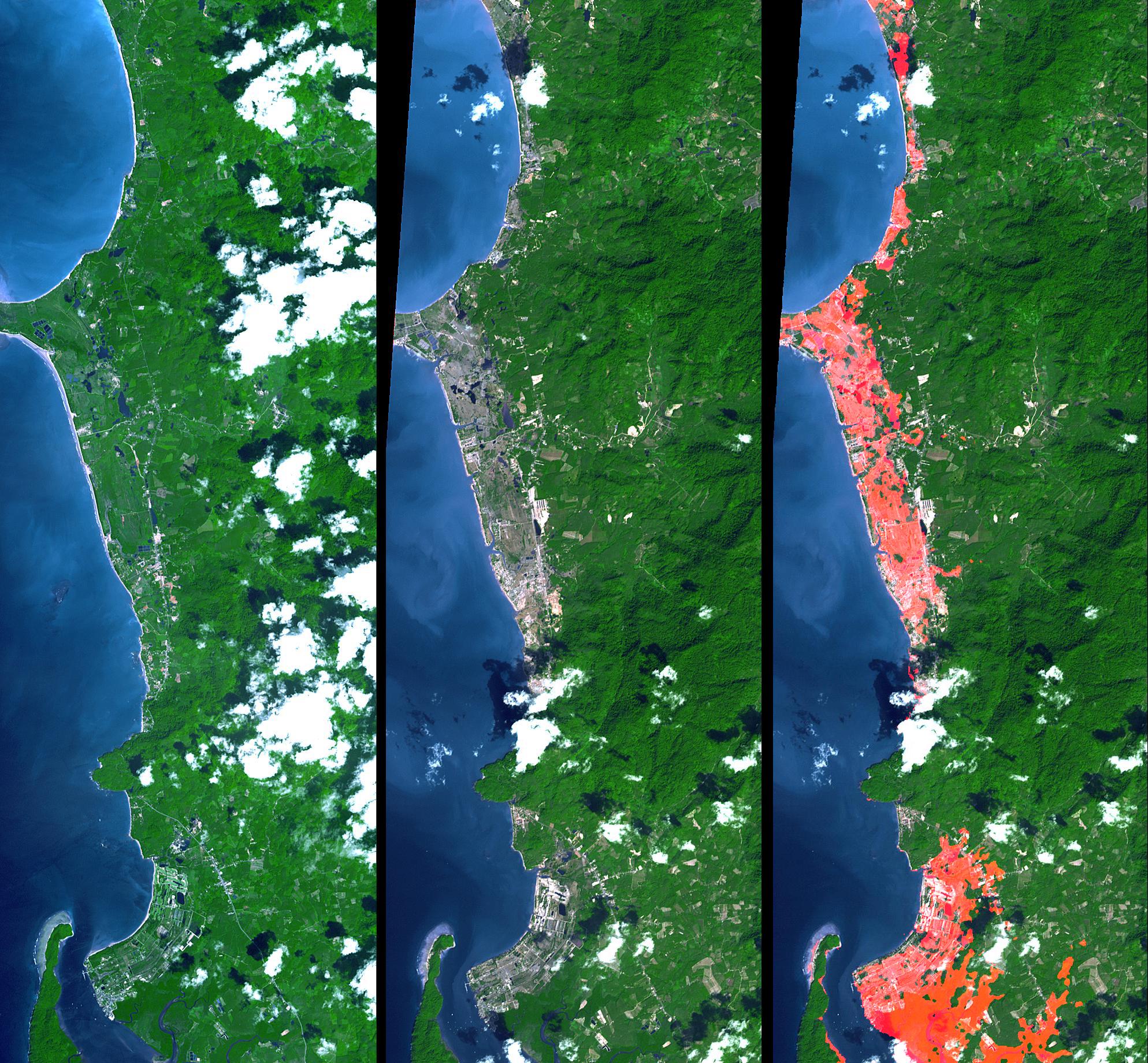
海啸淹没,泰国普吉岛北部<br />ASTER图像和SRTM海拔模型
这张来自美国宇航局Terra航天器的图像显示了泰国普吉岛以北的印度洋海岸线,是一个主要的旅游目的地,2004年12月26日海上大地震引发的海啸路径上。
Tags:
2005-01-14T22:50:59Z
,
This image from NASA Terra spacecraft shows the Indian Ocean coastline north of Phuket, Thailand is a major tourist destination that was in the path of the tsunami produced by a giant offshore earthquake on December 26, 2004.
,
大家在找
海啸
海啸
地震
地震
地震
你好
你好
你好
蟹状星云
海卫一
星环
星环
星环
土卫六
火星探测
机智号
200
台风
长征
2025
顶部