星目探宇
科普知识大合集
星目探宇
首页
奇妙科普
天文摄影
星地对比
科普视频
活动专区
留言区
NASA资料馆
去登录
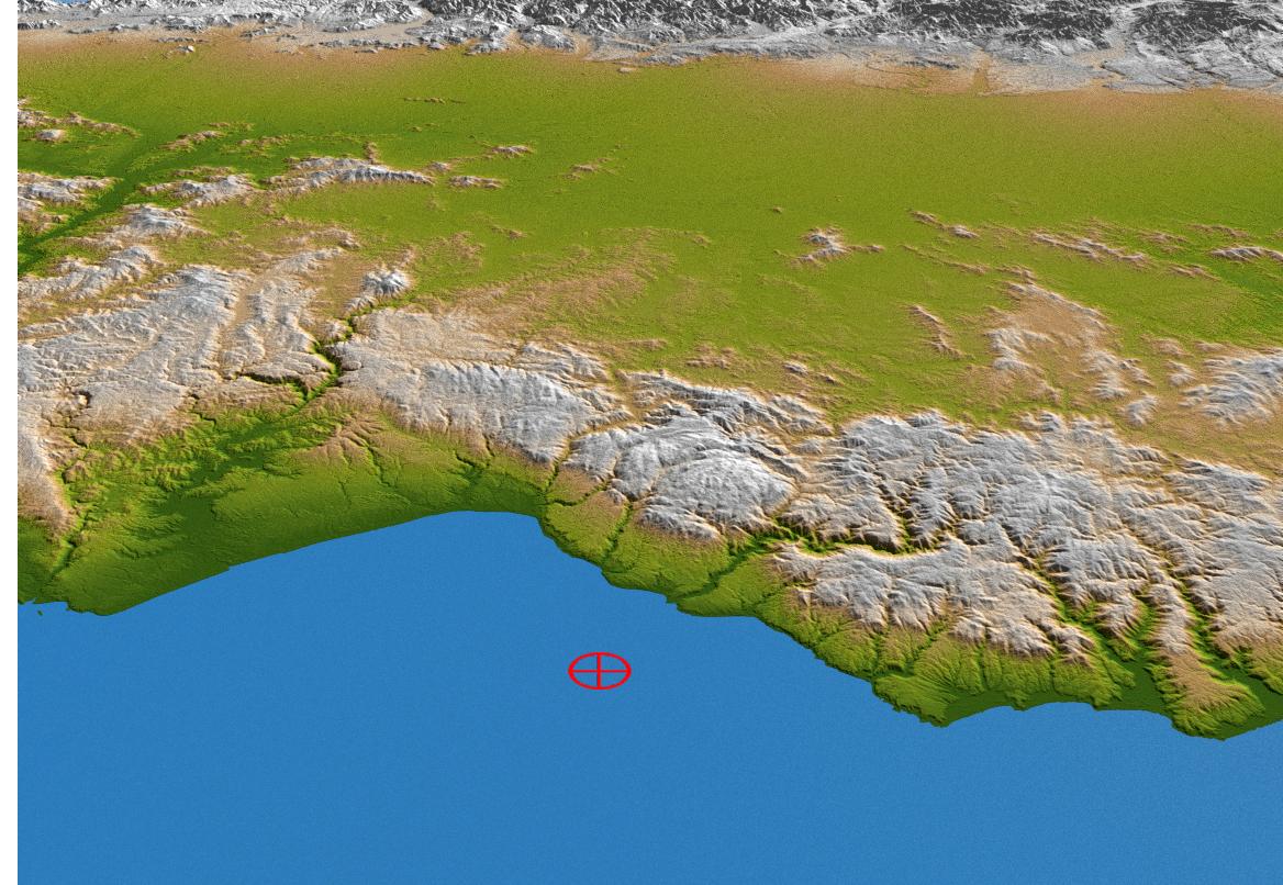
智利沿海透视图
这张来自美国宇航局智利沿海航天飞机雷达地形任务的透视图显示了2010年2月27日8.8级地震的震中红色标记,位于巴伊亚德钱科河莫莱地区近海。
Tags:
2010-03-04T02:17:02Z
,
This perspective view from NASA Shuttle Radar Topography Mission of coastal Chile indicates the epicenter red marker of the 8.8 earthquake on Feb. 27, 2010, just offshore of the Maule region in the Bahia de Chanco.
,
大家在找
海啸
海啸
地震
地震
地震
你好
你好
你好
蟹状星云
海卫一
星环
星环
星环
土卫六
火星探测
机智号
200
台风
长征
2025
顶部